Skip to land knowledge content

AVENTRIX REALTY

Tamil Nadu Land Knowledge Centre

Understand Tamil Nadu land records, land classifications and property verification.

START HERE

What are you trying to understand?

Choose a topic to jump into the part that matters to you. You can read the page from top to bottom, or use these shortcuts.

THE DOCUMENTS

Each record answers a different question.

No single extract should be treated as the entire legal history of a property. Match the survey number, subdivision, extent, boundaries, names and dates across available records.

Illustration of land-record papers being compared
PT

Patta

A revenue record identifying the person or persons recorded for a parcel and related survey details. It is important evidence, but it is not by itself conclusive proof of title.

What to cross-check

Patta number, survey and subdivision, extent, recorded names, transfer order and consistency with title deeds and other records.

CH

Chitta

A land-revenue record associated with ownership and land details. Availability and format depend on the relevant rural or urban record system and current portal.

What to cross-check

Reference number, survey identity, recorded holder and whether the extract is current and verifiable through the official service.

AR

A-Register

A village account with key survey-level particulars, which may include classification, extent, assessment and pattadar-related entries.

What to cross-check

Recorded classification, survey/subdivision, extent, land type and differences between old and current entries.

AD

Adangal

A village account traditionally associated with cultivation and crop details. Its content and role should be read in the context of the record and period concerned.

What to cross-check

Relevant season or year, cultivation details, survey number and whether the entry is being incorrectly treated as a title deed.

FMB

FMB / Field Measurement Book

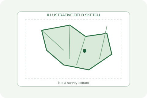
A field sketch used to understand surveyed parcel geometry, measurements and subdivisions. It helps with boundary investigation; it does not alone establish ownership.

What to cross-check

Correct village, survey and subdivision, adjoining parcels, scale/measurements and whether a licensed surveyor should inspect the ground.

TS

TSLR

Town Survey Land Register, used for relevant urban town-survey records. Urban records and rural village accounts are not always interchangeable.

What to cross-check

Town, block, ward, town survey number, subdivision and corresponding urban sketch or related extracts.

EC

Encumbrance Certificate (EC)

A registration search covering transactions recorded in the relevant period and search scope. An EC does not reveal every possible legal, possession or title issue.

What to cross-check

Correct property identifiers, search period, document numbers, names, link documents and possible unregistered claims or litigation.

PD

Parent and link documents

Earlier registered instruments and supporting records help trace how the claimed title passed from one party to another.

What to cross-check

Continuity of title, undivided shares, legal heirs, release/partition documents, court orders, powers of attorney and registration details.

Simple rule: revenue records, registered instruments, survey records and planning approvals serve different purposes. Compare them and obtain a professional title review where required.
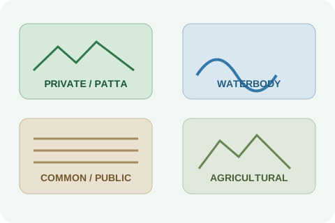
Illustration comparing private, waterbody, public-use and agricultural land categories

LAND CLASSIFICATION

The classification entry is a starting point — not the whole answer.

Read the exact wording in the relevant record. Similar-sounding labels can have different implications depending on the original settlement, the land's history, applicable law and later orders.

Agricultural

Nanjai

Traditionally associated with wet or irrigated agricultural land. The actual recorded classification and applicable land-use controls must be checked.

Agricultural

Punjai

Traditionally associated with dry agricultural land. The label alone does not establish that residential or commercial development is permitted.

Agricultural

Manavari

A term associated with rain-fed cultivation in relevant records. Confirm the exact classification in the village account and applicable rules.

Settlement

Grama Natham

A traditional village-residential land classification. The legal effect depends on the precise land, occupation, records and applicable court decisions.

Revenue entry

Natham Poramboke

A label that may appear in revenue records for land classified as natham poramboke. Do not infer ownership or eligibility for patta from the label alone.

Waterbody

Eri Poramboke

Land recorded in relation to a tank or lake. Check original survey records, tank registers, boundaries and the relevant water resources authority's records.

Waterbody

Kulam / Kuttai

Terms associated with ponds or small waterbodies in relevant local records. The precise classification and public use need confirmation.

Water channel

Vaikkal / Odai

Can refer to a channel, irrigation course or stream. Investigate historic flow paths, field sketches and department records before drawing conclusions.

Public use

River / watercourse

Riverbanks, channels and associated land may be governed by specific public, environmental, flood-management and water-resource rules.

Public use

Road / pathway

Road, cart-track or pathway entries may relate to public access or a recorded route. Confirm alignment, width and legal status on the ground and in records.

Public use

Mayana / burial ground

Land recorded for burial or cremation use. Do not treat it as ordinary saleable land without clear legal and official confirmation.

Public use

Grazing land / Mandhaiveli

Entries may refer to common village uses. Check the specific register, local-body records, settlement orders and restrictions.

Other entry

Tharisu / waste

“Waste” or uncultivated entries can describe a revenue or land-use status. They do not automatically mean unowned, freely transferable or buildable land.

Other entry

Rock / hill / forest-related

Local record labels vary. Forest, hill, assigned or specially regulated lands may be subject to separate statutes and department controls.

Urban records

Town-survey classification

Urban TSLR entries should be read with the town-survey sketch, local planning records and the relevant urban revenue authority's records.

This is an educational list of commonly encountered terms, not a complete or authoritative statewide taxonomy. Spelling, usage and legal consequences can vary by record, district and historical context.

SPECIAL CHECK

Waterbody and public-use land needs extra care.

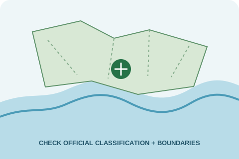
Do not rely on a single online extract when a parcel is close to a lake, tank, channel, stream, flood path, road or common-use area.

  • Compare old and current survey sketches.
  • Look for the relevant tank, water-resource or local-body register.
  • Check the physical boundary and access on site with a qualified surveyor.
  • Obtain written clarification from the competent authority if records conflict.
Open Tamil Nadu land e-Services
Illustration of a waterbody and surveyed parcel boundary

HISTORY IN CONTEXT

How Tamil Nadu land records evolved

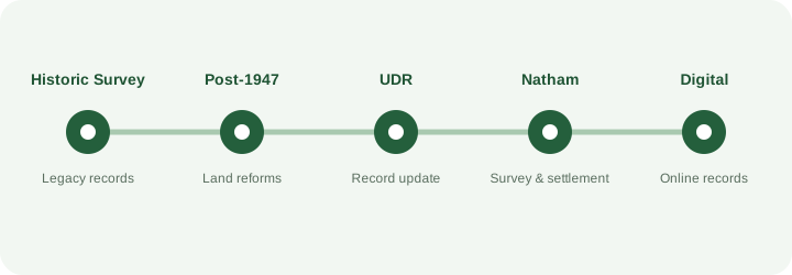
Survey and settlement, revenue administration, land reforms, record updating and town planning developed through different legal and administrative tracks. The timeline below is a high-level orientation, not a substitute for the relevant original order or statute.

Illustrated timeline from historic survey through land reforms, UDR, Natham settlement and digital records

First, the big picture

Today’s land records did not all begin at the same time. Different systems were created for different jobs: measuring fields, collecting land revenue, deciding tenure, recording village house sites, registering transactions and controlling development. That is why an old survey number, a UDR entry, a Natham patta and a planning approval may tell different parts of the story.

Early to mid-1800s · British administration

Systematic survey and revenue settlement

Under the Madras Presidency, colonial administrators expanded systematic measurement and revenue settlement, including the ryotwari system associated with Thomas Munro’s administration in the early 19th century. In ryotwari areas, revenue was assessed against individual cultivators or holdings; in zamindari estates, an intermediary estate-holder played a different role; inam lands followed their own grant and tenure histories. These systems co-existed, and they did not affect every village in the same way. Survey numbers, field measurements, village accounts and settlement registers grew out of these administrative needs. Practices and dates varied by district; there was no single survey event that created every record now used in Tamil Nadu.

Why this matters today

An old survey number, boundary or classification may come from a particular settlement operation. To trace it, find the original settlement register, village map, old FMB or other surviving record for that village.

1871 · Colonial revenue terminology

“Natham” already described village dwelling sites

A Revenue, Agriculture and Commerce glossary published in 1871 defined “natham” as the site of villagers’ dwellings, distinct from lands attached to the village. This helps explain why a village house-site area could be recorded differently from agricultural fields. It does not, by itself, decide the ownership of any present-day plot.

Records to look for

Original Settlement Register (OSR), Settlement Land Register (SLR), village accounts, old maps and any specific record that identifies the house-site parcel.

1905 · Madras Presidency

Land Encroachment Act

The Madras Land Encroachment Act, 1905 became part of the legal framework for dealing with unauthorised occupation of certain government lands. Its application depends on the land’s legal status and the applicable law; it should not be assumed to apply identically to every classification or occupied village house site.

Practical lesson

A “poramboke” or “natham” word in one record is not enough to resolve a dispute. Read the underlying record, the relevant statute and the current binding judgments together.

1947 onward · Independence and land reform

Estate abolition, inam legislation and ryotwari settlement

After Independence, Tamil Nadu (then Madras State) used different laws to abolish or change certain estates and inam tenures and to settle eligible lands under ryotwari arrangements. These were not one universal transfer of every parcel into private ownership. The legal result depended on the type of estate or inam, the governing enactment, eligibility and the order passed for that land. Land-ceiling laws formed another, separate part of post-Independence land reform.

Records to look for

Estate or inam records, settlement proceedings, ryotwari patta or other statutory orders, assignment records, appeal orders and court orders where relevant.

1971 onward · Planning law

Town planning became a separate approval track

The Tamil Nadu Town and Country Planning Act, 1971 established a statutory planning framework distinct from revenue survey and settlement. CMDA operates within its notified metropolitan jurisdiction; DTCP and other competent authorities apply where jurisdiction and law provide. A revenue classification is not a layout approval, and a planning approval is not proof of title.

Check separately

Verify the exact planning authority, approved layout status, land-use rules and building permissions for the site. Do not assume Chennai metropolitan rules apply everywhere in Tamil Nadu.

1979–1987 · Updating of Registry (UDR)

Revenue and survey records were updated

UDR is commonly described as a state exercise to update registry and prepare or correct survey and revenue records, including field-level checks and subdivisions where required. A training reference used by the National Academy of Administration describes the commonly cited 1979–1987 period; the specific government order and local records must be checked before attributing an entry to UDR.

Compare the record trail

Compare pre-UDR settlement registers and FMB with the UDR A-Register, UDR FMB, Chitta/Patta entries, subdivision proceedings and present extracts. A mismatch is a reason to request the underlying file—not to assume either record is automatically correct.

1987–1988 · Natham survey and settlement orders

Village house sites were surveyed through a distinct process

G.O. Ms. No. 1177 dated 30 October 1987 (Commercial Taxes and Religious Endowments Department) is commonly cited for initiating Natham survey and settlement; guidelines followed in December 1987, and G.O. Ms. No. 1971 dated 14 October 1988 (Revenue Department) set out settlement and ground-rent instructions. G.O. Ms. No. 454 dated 13 May 1996 is cited in the judgment as withdrawing the ground-rent levy, after which the scheme was treated as completed. The scheme addressed individual holdings in village natham areas and certain agricultural lands used for non-agricultural purposes. It was separate from UDR, and its history includes rough pattas, enquiries, records and later disputes.

Do not confuse these terms

“Grama Natham”, “Natham Poramboke”, “Natham patta”, “Natham Adangal” and an assignment of vacant land are not interchangeable. Identify the exact register, survey sketch, order and factual occupation history for the parcel.

1990s–2010s · Follow-up and digitisation

Records were maintained, disputed and progressively brought online

After survey and settlement exercises, revenue departments continued record maintenance, mutation, correction and appeal work. Computerised services later made selected extracts available online, but the digital record is not necessarily the complete historical file and may not show every old boundary or order.

What to request when online data is unclear

Ask the competent Taluk/Survey and Land Records office for certified copies of the relevant old and current registers, FMB/town-survey sketch, subdivision proceedings, mutation orders and settlement or assignment file.

2021–2025 · Later Natham administration

Pending cases and classification questions continued

Later Government Orders and departmental instructions addressed held-over Natham cases, classification/record terminology and patta-related administration. For example, the 2026 Full Bench judgment discusses G.O. Ms. No. 233 dated 5 February 2021, G.O. Ms. No. 221 dated 4 May 2023 and G.O. Ms. No. 869 dated 30 September 2023 in this context. The exact effect of each order depends on its complete text, issuing department, amendments, the parcel and later directions; the dates alone do not create a right to a patta. Do not treat a general summary—or a recent order number alone—as a grant of ownership or a guarantee that a patta must be issued.

What must be verified

Obtain the full official text and annexures of the relevant Government Order, check whether it applies to the village and land category, and confirm later amendments, circulars and orders.

6 March 2026 · Madras High Court Full Bench

Important ruling on occupied Grama Natham

In Nallasivam v. The District Collector, the Full Bench answered the referred question that occupied Grama Natham lands do not vest with the Government and that the Tamil Nadu Land Encroachment Act, 1905 cannot be invoked in respect of occupied Grama Natham lands. This is a significant legal development, but it is not a blanket ruling that every Natham parcel is privately owned, that vacant Natham may be occupied, or that every patta/title dispute is resolved. The official judgment and any later review, appeal, stay or clarifying decision must be checked before relying on it in a live matter.

Safe way to apply this

First establish the exact classification, whether the site is occupied or vacant, the relevant survey and settlement records, the nature of the proceedings and the current binding case law. Obtain legal advice for a specific dispute.

Today · Online services and physical records

Use digital extracts as the starting point—not the end

Official portals help locate available Patta/Chitta, A-Register, FMB, TSLR and registration services. A sound property review connects those current extracts to historical settlement records, title deeds, encumbrance searches, boundary verification and planning permissions.

A practical rule

If names, extents, survey numbers, boundaries or classifications conflict, stop and obtain certified records and a professional review before paying an advance or proceeding with a transaction.


How the history connects to one plot

  1. Find the earliest available record. Note the old survey number, village, extent and classification.
  2. Trace each change. Compare original settlement/OSR/SLR records, old FMB, UDR records and later subdivision or mutation orders.
  3. Check the land category carefully. Agricultural ryotwari land, estate/inam land, village natham and public-use/poramboke land have different histories and legal tests.
  4. Verify the present position. Check title documents, EC, current revenue extracts, on-ground boundaries and planning approval separately.
Historical research note: dates and government-order numbers must be verified against full official texts before being used to decide a particular parcel's status. See the source-audit document in the project package.

DO NOT MIX THESE UP

Revenue records, title and planning approval are different systems.

Use each record for the question it is designed to answer.

A

Revenue / survey records

Question: How is the parcel recorded in revenue and survey systems?

  • Patta / Chitta
  • A-Register / Adangal
  • FMB / TSLR
  • Classification and survey history

These records are important but are not, by themselves, a complete title opinion.

B

Title and registration

Question: What instruments and legal events support the claimed ownership?

  • Sale / settlement / partition deeds
  • Parent and link documents
  • EC and registration searches
  • Legal-heir, court or assignment records where relevant

Registration and EC searches also have scope limits; a professional title review may be necessary.

C

Planning and development

Question: What development or land use is permitted under the applicable plan and rules?

  • CMDA in its notified metropolitan planning jurisdiction
  • DTCP / other competent planning authority where applicable
  • Approved layout and planning permission
  • Building permission and conditions

Planning approval does not itself prove clear ownership or remove restrictions from a parcel.

A SIMPLE EXAMPLE

A plot may have a Patta entry and still need more checks.

Confirm the title chain, the precise survey boundary, access, classification, applicable master plan, layout approval, building rules and any waterbody or public-use restrictions before committing.

Illustrative field measurement sketch with a marked parcel

BEFORE YOU BUY

A practical land due-diligence checklist

Tick off the checks as you collect documents. This is an educational aid, not a certificate that a property is safe to buy.

Illustration of a completed property due diligence checklist
Your checklist progress0 of 10

COMMON QUESTIONS

Quick answers, without the jargon.

Does a Patta alone prove ownership?

No. Patta is an important revenue record, but a proper title assessment usually requires the registered instruments, link documents, relevant orders, boundaries and other facts. The weight of each record depends on the case.

Does an approved layout mean the title is clear?

No. Planning or layout approval and title are separate matters. Check the approval's validity and conditions, and independently review ownership and encumbrances.

Does “poramboke” always mean the same thing?

No. The precise record entry, context, historic records, land use and applicable legal framework matter. Do not make a decision from a generic label alone.

Are UDR and Natham Settlement the same?

No. They refer to distinct administrative exercises. For a particular parcel, compare the original records and the orders governing the relevant exercise.

Can online land records replace old records?

Not always. Online extracts are useful starting points, but historical or disputed parcels may require original registers, old survey sketches and certified proceedings from the competent office.

Can this guide tell me whether a property is safe to buy?

No. It explains what to investigate. It cannot decide title, eligibility for patta, buildability or the outcome of a legal dispute for a specific property.

VERIFY FROM THE SOURCE

Official portals and legal references

Use official services to locate available records. For legal conclusions, consult the full statute, Government Order and binding judgment relevant to the specific issue.

Land-record documents

MAKE A MORE INFORMED PROPERTY DECISION

Start with the records. Verify the facts. Then decide.

Use this guide as a learning resource and obtain independent professional advice for a specific property.

Open Government Property Services
WhatsApp